After going on a tour of the Lower Mill River History Trail two weeks ago, this week I returned to hike up the other way. Once again, the tour was led by the indefatigable Bryan Harvey. It was another fascinating dive into the lost industrial history of North Amherst.
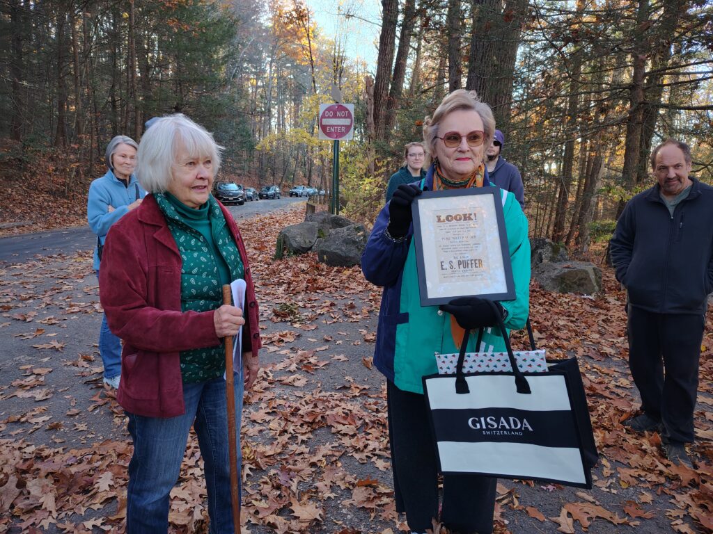
The Mill River History Trail is a project of the District One Neighborhood Association (DONA) in Amherst. (Meg Gage, pictured not holding the sign, is president of DONA.) DONA has received two small infusions of the Community Preservation Act funds to carry out the project. There are plans to put up some interpretative signs and make some improvements to improve the ability to view the remains, and create some public displays of artifacts, documents, and images.
We started in the same place and, this time, walked upstream along Cushman Brook through the other half of Factory Hollow. Barbara Puffer (pictured at left holding an advertisement from the ice business her grandfather ran at Puffers Pond) explained that it’s pronounced “Factory Hallah”.
Above Puffers Pond, there was a whole series of additional dams. The river flows through a fairly narrow gorge which is currently a series of rapids. But in multiple places you can see the stone work for mill wheels, raceways, and the abutments for dams.
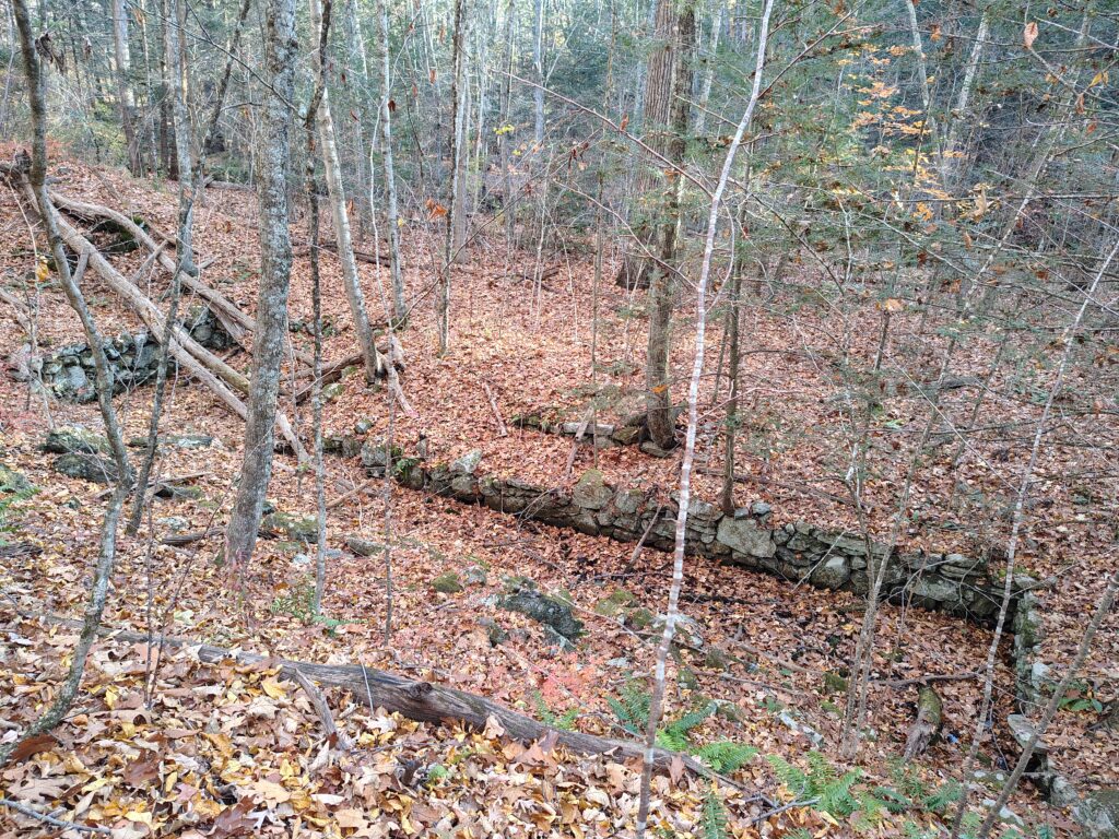
The first dam was for the Roberts Lower Mill. The abutments for the dam are visible under a pedestrian bridge that crosses the river. The current trail probably runs through where the mill building actually stood. There is stonework visible (pictured right) that was where the mill wheel rotated and you can see some indications where the flume and tailrace were. Wikipedia has a pretty good page that describes the operation of watermills that explain some of the terminology. There are indications the mills mostly began with water wheels, but some converted to use turbines. It would be interesting to see what the actual designs were.
Above that was the Roberts’ Upper Mill where, again, the abutments are visible as well as stonework for mill wheel and raceway.
A railroad track crosses the Cushman Brook where the gorge is quite deep. The trail here is impractical to follow for anyone but mountain goats, so the tour returned to State Street and hiked up past the tracks.
Just beyond there is some old housing that may have been originally constructed for mill workers with the foundations of a mill just behind. This area was among the most densely occupied of the mill sites, with four or five different mills in just a few hundred yards. Little remains but foundations and stonework.
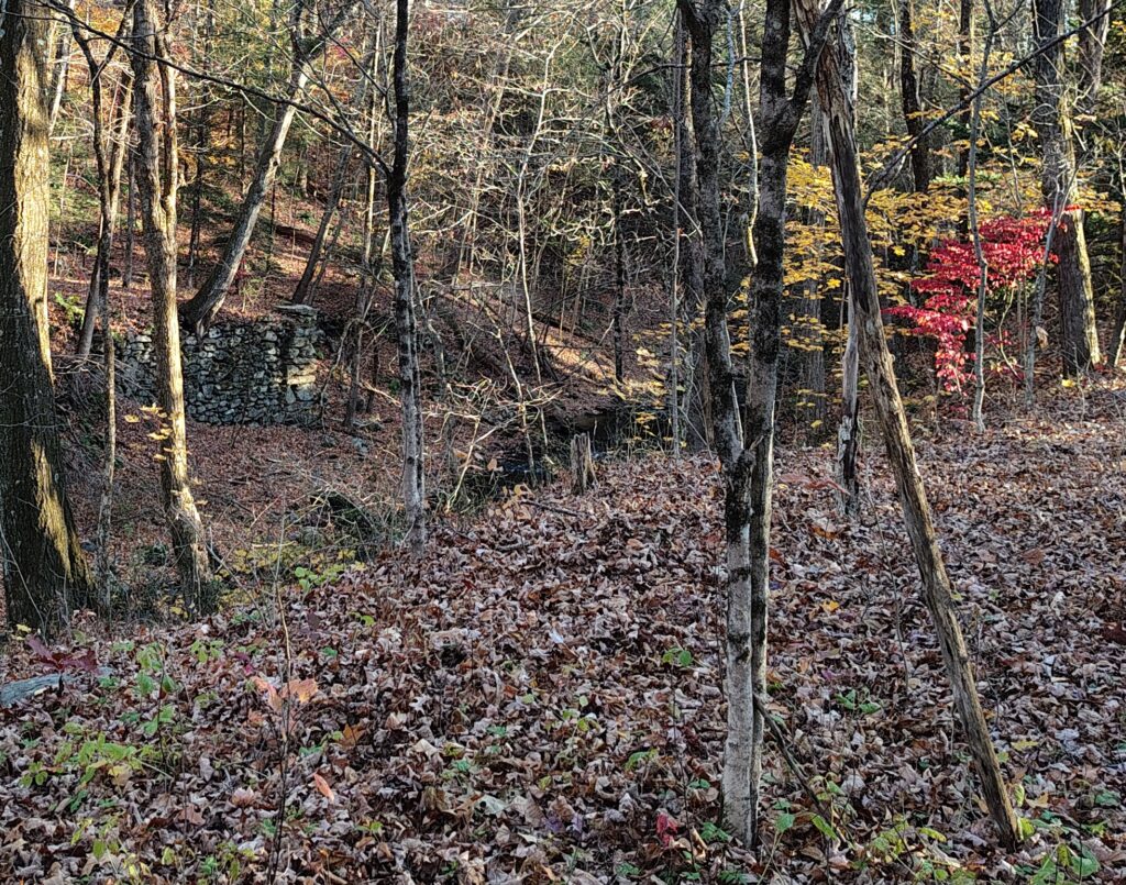
On the other side of Cushman Brook, you can see the foundations of the Barnard Forge (pictured left). It operated from 1830-1860. It manufactured “frogs” for railroad switches and the forge had planned on being in place when the railway expanded from Amherst Center north. A bank panic caused a recession in the 1850s that caused the forge to fail in 1860. The railway eventually reached the area just six years later. The building and site were reused for cotton batting and, later, wool fulling.
State Street ends at Bridge Street. At this intersection, the first mill was sited in 1727. The site was occupied a series of mills that lasted into 1920s. We followed a trail along Bridge Street to the current bridge (constructed in 1972) where you can see the footings of the previous Old Bridge and Silver Bridge and the foundations of the last mill at the site. There is also just barely visible the brick “steam house” constructed over the lip of the gorge that housed the steam engine that drove the mill after it was converted from water power. We didn’t talk about this, but I wonder the extent to which the conversion to fossil fuels (steam and, later, electricity) allowed mills to no longer be sited near water power.
We crossed Bridge Street briefly to look down at the footings of the Silver Bridge and to see the abutments of a final dam that had created Cushman Pond which, at one time, was quite large, perhaps 60% of the size of the Puffers Pond.
On the walk back, Bryan didn’t stop periodically as he had previously. Due to my lung condition, I couldn’t walk fast enough to keep up with the group and fell farther and farther behind. I could sort of hear some of what was said for a few minutes, and it sounded like a lot of it was a reprise of contextual information he’d provided in the tour of the Lower Mill River, so I didn’t feel like I was missing that much. When we reached my car, rather than going to the conclusion of the tour, I just got in and drove home.
Upon reflection, I realized that they’ve really missed an opportunity to brand the tours, though. Clearly it should be called, “Grist for the Mill: Another Dam Hike with Bryan Harvey.” Once again, it was interesting, entertaining, and informative. Well worth the time and cost of admission.